Arctic Circle Trail | GET INFORMED
Are you captured by the idea of escaping the real world, switching off your phone, forgetting about the hectic rhythms of everyday’s life and having a glimpse of how it feels to spend one whole week in close contact with nature and silence?
If your answer is a big fat YES, then I can assure you, the Arctic Circle Trail will not disappoint you. Pick up pen and paper and start realizing this dream!
At first, it can be difficult to gather all the information to plan a long hike.
This post will guide you through the most common questions that usually fill up my brain when I start dreaming about hiking a new trail.

… I know, it can be a bit overwhelming, but if I managed to organize this once-in-a-lifetime trip, so can you. One step at a time, one question at a time… happy trail planning!
What is the Arctic Circle Trail?
The Arctic Circle Trail (ACT) is a 165 km long trail which spans between Kangerlussuaq and Sisimiut, from ice sheet to sea, along a large ice-free area of Greenland’s west coast. The trail is equipped with very basic huts at regular intervals, although wild camping is also allowed. Hikers usually take between 7 and 10 days to complete this trekking.
What kind of experience does it offer?
This trail provides the great opportunity to explore Greenland in a unique way. It allows to experience a very deep contact to nature, to disconnect from the real world and the hectic rhythms of everyday’s life.
Long story short, forget about annoying alarms, social media, chat and email notifications… there is no phone reception!
Although the ACT is becoming more popular over the years, it is not a highly frequented trail. You will experience long periods of time in solitude and, who knows, you might enjoy it and take the chance to better get to know yourself.
I will never forget the emotions I felt while admiring the vastness of the landscapes. The peaceful stillness of Greenland made me slow down, taught me how to appreciate the sound of my breath and of my thoughts, and more importantly made me feel alive.
That being said, it is important to note that a thru hike will always provide a different and unique experience to every hiker. Don’t hesitate, buy that ticket plane and live your own adventure!
Where can I find useful information?
The planning phase of a long-distance hike can easily become tricky and overwhealming. Sometimes, too many information are present on the web, making it hard to choose the right one to start with. Sometimes, too few information are available, making the planning even harder. Here you can find the pages that I personally used to organize my trip on the ACT.
The website: this website helped me through the organization of the trip, as it includes wonderful insights.
The book: as soon as I decided to make this dream of mine become reality, I purchased this book guide from Cicerone, revised in 2019. It helped me in the planning of the stages and I brought it with me on trail.
The facebook group: this facebook group is a great place to ask questions and find particularly useful insights, directly from people who already hiked the trail or that are in the same planning phase as you. When I was planning my trip, I participated to a conference organized by this group’s administrators… it was a great opportunity to freely ask questions.
The Trail Chat: feel free to ask me anything about the trail, I am always happy to help and support you during the planning phase of your thru hike!
The ACT maps: 3 hiking maps (Kangerlussuaq, Pingu and Sisimiut) cover the whole length of the trail. I recommend to purchase them before heading out for your adventure. I know, who needs paper maps if you already have a GPS device? I even admit that I rarely take with me physical maps of a trail, but the ACT is very remote, and I would not rely entirely on a electronical device. The maps can be also purchased directly in Kangerlussuaq (at the airport or at the Polar Lodge) and in Sisimiut (at the Hotel Sisimiut).
Which difficulties will I face?
The trail itself is not difficult, but could become tougher in bad weather conditions and with a heavy pack on your back. I would not recommend it as a first-time thru hike, but I think that anyone with experience of being self-sufficient for several days while hiking, with the right equipment, enough planning and a moderate fitness level, will be able to thru hike the ACT.
Due to the remoteness of this trail, there are some important points that need to be considered:
HEAVY BACKPACK
You must be completely self-sufficient while on trail. Therefore, your backpack can become very heavy if you don’t plan your equipment list well. More importantly, make sure you know how to use your equipment before heading out into the unknown! You can find a list of the equipment and food we brought with us in the posts EQUIPMENT and FOOD.
TRAIL CONDITIONS AND WAYMARKS
The trail is in general well marked, mainly with cairns showing a painted red semicircular mark. These cairns are rather easy to spot on higher grounds, but sometimes vanish when the trail goes through muddy terrain or become difficult to spot in case of bad weather. This is why navigation skills are essential. Also consider that muddy terrain can be very tiring for your legs, so we advice not to underestimate the length of the stages. You can find out more about the suggested stages in the post OUR STAGES.
REMOTENESS
The trail leads hikers far away from civilization. We strongly advice to carry a GPS device that also has a SOS button, which can be pressed for alerting authorities in emergency situations. If you are curious to see which devices we brought with us, head to our EQUIPMENT post.
RIVER CROSSINGS
There are some river crossings along the ACT that can become tricky when water levels are high, particularly in June or in case of bad weather. This is honestly what I feared the most when planning this trail. Make sure you choose the best spot for crossing them where the river is broad and shallow, use trekking poles for stability and slightly face the current while proceeding with short steps. We also recommend not to cross rivers barefoot, to avoid injuries. As we travelled in September, we personally had to cross only one river worth of consideration, described in the post OUR STAGES. You can also find a good river crossing tutorial on Youtube.
WILDLIFE
Do not worry, polar bears prefer the cold and isolated environment of North and East Greenland, so it is very unlikely to spot one on the ACT. However, make sure to be fully prepared and read these instructions from VisitGreenland about how to handle the situation in case of an encounter. To be honest, the animals I would fear the most are mosquitoes, which could become very nasty during the warmest months in Summer. Make sure to bring a mosquito net and repellent with you!
Along the trail you can spot a variety of animals, including shy reindeers, curious rabbits, peaceful musk oxen, and foxes. Treat the wildlife with respect, try not to disturb the animals by always keeping a good distance from them (at least 100 m), and don’t try to feed them.
LEAVE NO TRACE
It is strongly adviced not to dispose of your trash at the huts along the trail. Because of their remoteness, no one is picking it up for long periods of time, and trash will just accumulate there. Therefore, make sure to respect the nature you are visiting and always follow the “leave no trace“ principle, by picking up and carrying your own trash until the end of the trail.
When is the best time to hike it?
The ACT is typically considered a Summer trail and can be mostly hiked from mid June until mid September to avoid snow, cold weather and dangerous river crossings. The weather can be unpredictable, but it is generally better in late Summer, allowing for better walking conditions on drier ground. In general, it might be helpful to remember that when the wind blows from the ocean (West) towards the inland (East), bad weather could be expected.
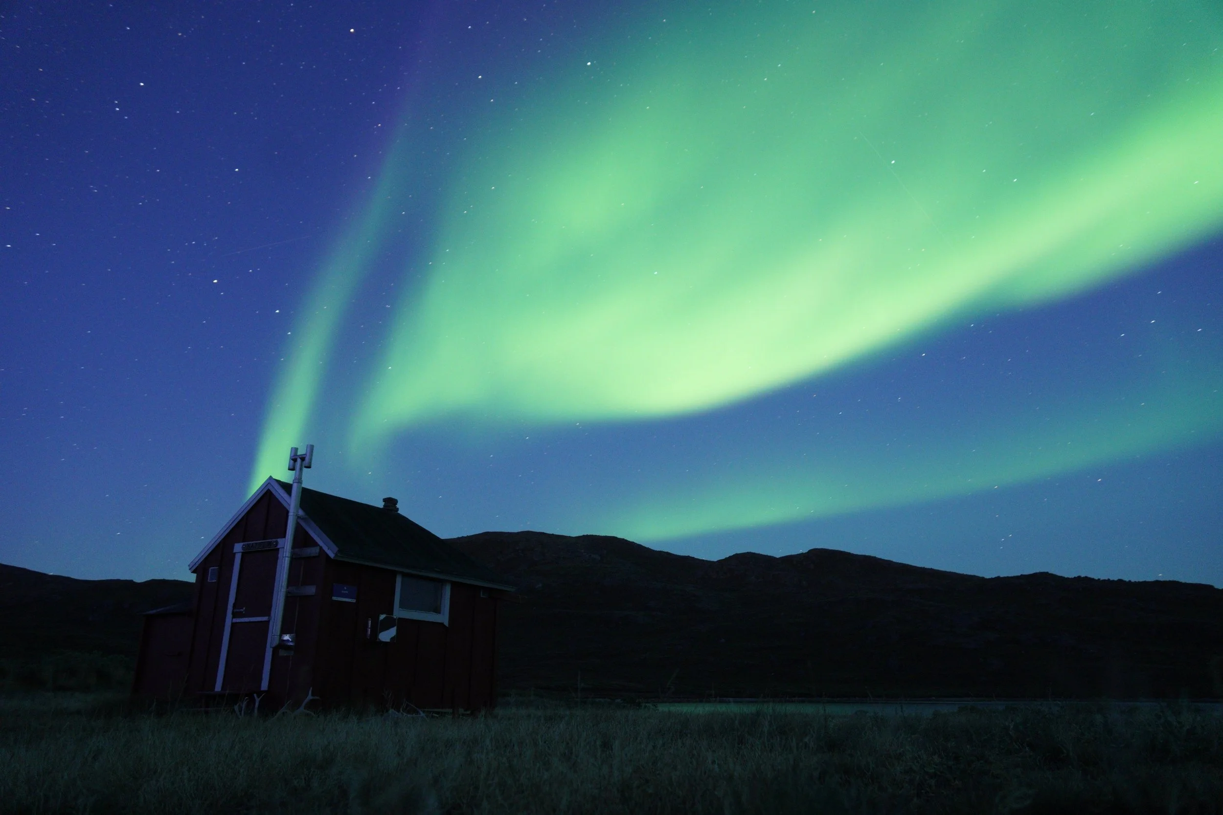
From my personal experience, I would recommend to hike it beginning of September, because mosquitoes could become very annoying during the warmest months. Moreover, in September, you will have higher chances to spot the northern lights!
How do I reach the trail?
If you have read the above information about the ACT and decided that you want to embark on this amazing adventure, it is time to start thinking about how to actually reach the trail.
The easiest way to reach Greenland is from Copenhagen (Denmark). Almost daily, there are direct flights of Air Greenland from Copenhagen to Kangerlussuaq, which hosts the only international airport of Greenland. If you are planning to hike the ACT in the opposite direction or to fly home from Sisimiut, connection flights between Kangerlussuaq and Sisimiut are also available.
If you are planning to prolong your stay in Greenland and visit the country, bear in mind that there are no long roads connecting the villages. Travel within the country happens either by air or by ferry and is not so straightforward. Therefore, before purchasing any plane or ferry ticket, make sure you prepare a rough schedule of your trip.
In the post OUR TRIP you can find our travel schedule, which might give you some inspiration.
What should I pack?
You will find a detailed list of all the equipment and food we took along with us in the posts EQUIPMENT and FOOD.
Here I will just try to answer the most frequently asked questions during the planning phase of this thru hike.
Where can I buy fuel for my camping stove?
We purchased two gas canisters (230 g), one for each of us, at the Pilersuisoq Supermarket in Kangerlussuaq.
You can resupply with fuel at both ends of the trail, either in Kangerlussuaq (Pilersuisoq Supermarket, Kang Mini Market, Polar Lodge, Old Camp and Ishuset) or in Sisimiut (Supermarket, Starh hardware store, Hotel Sisimiut, Sisimiut Outdoor). Just make sure that the gas canister fits with your stove!
Where can I resupply for food?
The ACT is a wild adventure and there are no resupply points along the way. This means that you should be self-sufficient and carry all your food for the planned duration of your hike.
In both Kangerlussuaq and Sisimiut you can find a wide variety of trekking food for resupplying before hitting the trail.
Since for the first time we wanted to experiment a bit, dry our own food recipes at home and plan our meal schedule, we brought all our dried trekking food from home. We then bought energy bars and fresh food (bread, cheese, cold cuts) directly in Kangerlussuaq.
How much water should I carry?
I personally carried 2L of water with me every day but never drank it all during the stage. There is plenty of water along the trail, which can be collected from a running source or from a clean (not stagnant) lake. We always filtered the collected water, even though we were told it was not really necessary.
Where can I leave my normal clothes?
Additionally to our trail backpack, we brought a bag containing our “normal“ clothes, to wear in the towns after the hike. We then stopped by the post office in Kangerlussuaq, which is open during week days, and shipped our bags to the post office in Sisimiut, making it very clear that they should be stored until our arrival after the ACT and asking if the post office in Sisimiut would also be open. Everything went well. However, if the post office is closed, I would ask for advice at the airport or at Polar Lodge. Maybe a shipment by air would be an option, or you can also think about storing the bags in Kangerlussuaq until your way back if you don’t really need them.
How much money will I spend?
For the entire trip we both spent 5’000 CHF each… I know, WTF?!
First of all, you must consider that Greenland is not the cheapiest place to visit, but this budget can be easily reduced.
For us, it was very clear that Greenland was a once-in-a-lifetime destination and we wanted to make the best out of this adventure. For this reason, we decided to spend more time in the country after hiking the ACT. Additionally to all the flights we booked, we did not stay at the chepiest hotels in the towns. We also took part to some rather expensive guided tours and activities, all described in the post OUR TRIP.
I think that, with a good planning and without additional touristic expenses, the budget for this trip could easily be reduced to 2’500 - 3’000 CHF.
Long story short, don’t get discouraged and plan your own adventure!
CASH OR CARD?
We mostly payed by credit card all the accommodations and activities. However, it is always useful to bring some cash (DKK) along, so we decided to withdraw 600 DKK each at the airport in Copenhagen. You don’t have to worry, there are ATMs at both ends of the trail.
Want to read more about the
Arctic Circle Trail?